Virbalis
 |
It is frequently mentioned in historical as well in modern literature. In 1529–67 Virbalis was mentioned in the lists of non-privileged cities of the Grand Duchy of Lithuania. In 1536 Virbalis received the privilege of founding the city and a market. In 1555 a church was built. In 1576 it was allowed to held markets in Virbalis. In 1593 Virbalis received the Magdeburg rights and the coat of arms. In 1601 a workshop of various crafts was established, in 1602 – a shoemaker and tailors' workshop. From 1643 to 1819 there was a Dominican Monastery, and in the middle of the 17th century a Dominican Church was built in the city (which was blown up in 1944). In 1646 a Virbalis Parish School is mentioned. It was the site of the formation of the Virbalis Confederation (Konfederacja w Wierzbołowie) by Janusz Radziwiłł in 1655 during the Deluge (part of the Second Northern War) whose main purpose was to defend the King of Poland and Grand Duke of Lithuania John II Casimir Vasa. In 1785–1819 there was a three classes school, in 1819–70 a parish school, and later a public school.
When in 1861 a branch of the Saint Petersburg–Warsaw Railway was built through Virbalis from Vilnius to the Prussian border, where it was linked to the Prussian Eastern Railway, the Russian border station near the village of Kybartai was named after the neighbouring town of Verzhbolovo. Meanwhile, Kybartai has become a town bigger than Virbalis, and the Lithuanian border station is now called Kybartai, too. It was the first station for stagecoaches and later the first railway station in the Russian Empire when leaving Prussia. A steam locomotive was parked at the railway station to transport the tsar around Russian Empire (since it was the border of the empire). The German station of the Prussian Eastern Railway on the western side of the frontier was Eydtkuhnen (Eitkūnai); today, as consequence of the annexation of the northern part of East Prussia by the Soviet Union in 1945, it is a Russian border station and is called Chernyshevskoye (Черныше́вское).
Following the restoration of Independence of Lithuania in 1918, Virbalis became part of the restored Lithuania and had a power plant, a brick factory, 3 windmills, an oil press, cement workshops, lubricants workshops, a small credit society, as well as branches of the Lithuanian Christian Democratic Party, Lithuanian Nationalist Union, Lithuanian Farmers Union, Pavasarininkai, Lithuanian Riflemen's Union, and young Lithuanians (jaunalietuviai). In 1932 Virbalis received second-class city rights. In 1924 a Vilkaviškis–Marijampolė bus line was opened through Virbalis, which one of the first bus lines in Lithuania.
Between mid-July and autumn 1941, an Einsatzgruppe of German SS troops aided by local Lithuanian auxiliary police from Virbalis and Vilkaviškis slaughtered 670–700 Jews from Virbalis and the nearby town of Kybartai in several mass executions. A memorial was built on the site of the massacre. About 80% of Virbalis' buildings were destroyed during World War II. Following the Soviet occupation of Lithuania in 1944, Virbalis was the central settlement of the collective farm.
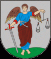
In 1993 the coat of arms of Virbalis was approved.
Map - Virbalis
Map


Country - Lithuanian_Soviet_Socialist_Republic_(1918–1919)
 |
 |
| Flag of Lithuania | |
Germany had lost World War I and signed the Compiègne Armistice on 11 November 1918. Its military forces then started retreating from the former Ober Ost territories. Two days later, the government of the Soviet Russia renounced the Treaty of Brest-Litovsk, which had assured Lithuania's independence. Soviet forces then launched a westward offensive against Estonia, Latvia, Lithuania, Poland and Ukraine in an effort to spread the global proletarian revolution and replace national independence movements with Soviet republics. Their forces followed retreating German troops and reached Lithuania by the end of December 1918.
Currency / Language
| ISO | Currency | Symbol | Significant figures |
|---|---|---|---|
| EUR | Euro | € | 2 |
| ISO | Language |
|---|---|
| LT | Lithuanian language |
| PL | Polish language |
| RU | Russian language |